Current Status
As part of the Exploration and Exploitation Program in the Patraikos Gulf (West) Lease Area, HELPE Patraikos has fulfilled the contractual obligations for the first Exploration Phase completing with absolute success specialized geophysical surveys and upon entering the second Exploration Phase is already planning the execution of the first exploration well.
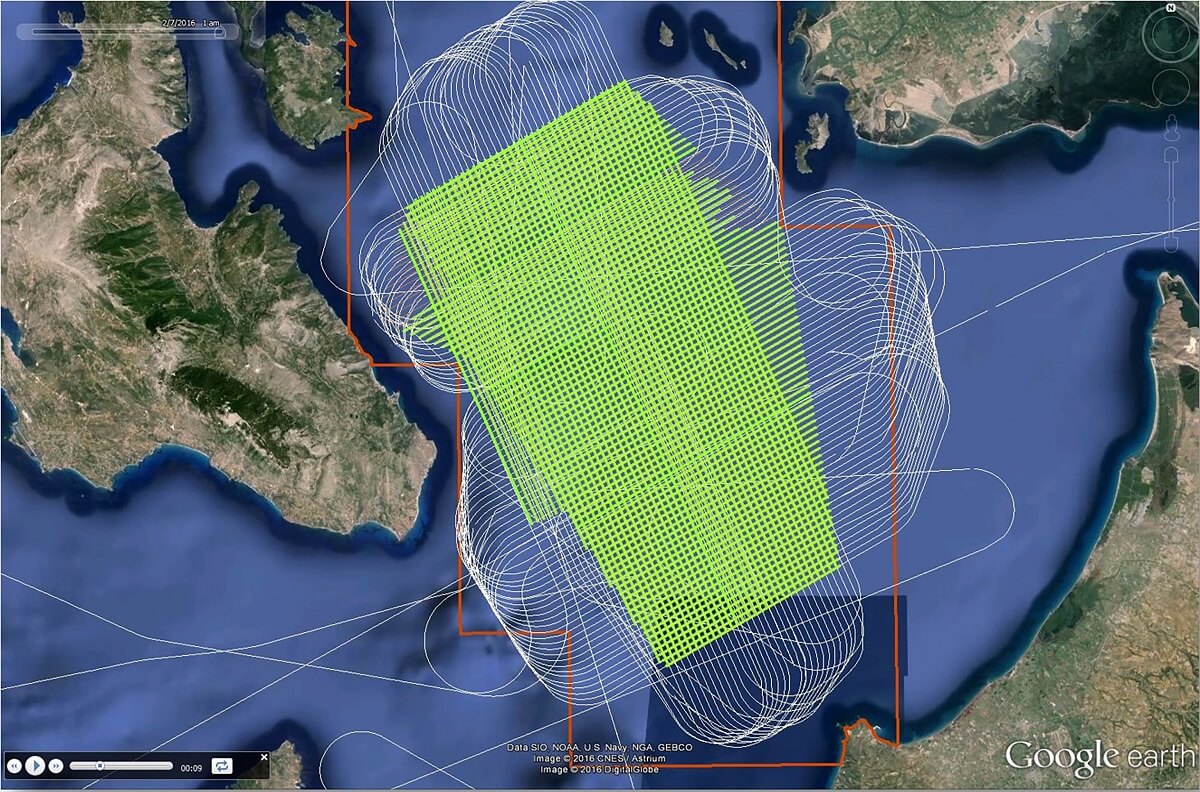
During the period January to February 2016, HELPE Patraikos completed with absolute success, complying fully with its commitment for zero environmental footprintt in the area of West Patraikos Gulf, a new three-dimensional (3D) and two-dimensional geophysical program. Prior to the commencement of work, HELPE secured all necessary permits for the execution of the project.
During the surveys, the most up to date technological methods were applied, absolutely safe and environmentally friendly, with full respect for the local communities and their existing activities. As part of the geophysical surveys, a detailed environmental action plan was submitted and approved by the competent environmental authorities, adopting strict protection measures and actions for the protection of marine mammals and protected areas in the Western Patraikos Gulf.
During the surveys, on a daily basis, specialized scientists observed the wider area within a radius of 2 km for the presence of marine mammals, listening in parallel to the sounds of the sea for their early detection and immediate cease of operations within a protection zone of 750 m. In addition, in collaboration with the University of Patras, measurements of the noise levels were recorded in the wider region both before and during the surveys, but also after their completion, confirming the low noise levels generated by geophysical surveys.
Upon completion of the geophysical data processing and newly acquired geophysical data, which have confirmed and mapped the primary geological target, HELPE Patraikos is preparing the execution of the first exploration well. Prior to the commencement of the exploration well, HELPE Patraikos is committed to prepare and submit an Environmental Baseline Survey (EBS Stage 2) more specific this time, which shall cover a limited area around the drillable target. As part of the survey and in collaboration with the Hellenic Center for Marine Research (HCMR), HELPE Patraikos conducted a detailed assessment for potential geo-hazards covering the mapped prospect area as well as the collection of critical environmental data in the wider area of the West Patraikos Gulf.
During the survey, experienced scientific personnel with specialized scientific equipment conducted a thorough investigation of the sea floor in order to avoid any anchoring problems during the execution of the 1st exploration well, as well as the collection of water samples, benthic organisms, fish catches etc. In addition, HELEP Patraikos in collaboration with Nature Conservation Consultants (NCC) and the Non-Governmental Organization for Protection of the Monk Seal (MOm), is conducting an extensive Environmental Monitoring Program for the monitoring and study of protected species (including seabirds and sea mammals) in Patraikos Gulf Area.